Tag Archives: Tour de France

Aix-en-Provence & Lambesc route

Abbaye de Silvacane

Abbaye de Silvacane

Founded in 1144 by monks of the Cistercian order, the site for Silvacane was located next to the Durance Rivière in an area overgrown with reeds. A cave-dwelling group known as the Pontistes hermits lived in the high ridges to the south during the eleventh century and maintained the Chapelle of Ste-Anne de Goiron. There is some evidence that they founded Silvacane.

At the end of the twelfth century, two counts endowed the abbey with income property that allowed relative wealth for the monks. In 1289, the envious Benedictine monks of Montmajour Abbey near Arles attacked Silvacane and took the Cistercians hostage. After much negotiation (and probably payment of ransom), the Benedictines released the hostages.

Cours Mirabeau view west

Aix-en-Provence Cours Mirabeau view


After 123 (Before the Common Era) BCE, Romans started settling in the area around what is now the St-Sauveur Cathedral. In honor of Caius Sextus and numerous springs, the outpost named the village Aquae (the waters of) Sextiae. By the end of Roman domination late in the fourth century, the Roman colony levered its resources and spa to a privileged community at the crossroads of Italy, Spain, and on the paths of transhumance between the lowlands and mountains.

Then around 400 (Common Era) CE, the Archdiocese moved into the city. After the demise of the Roman colony in the fifth century, the Visigoths conquered Aix. During the following two centuries, thetown was constantly under attack by the Franks and the Lombards. It was a very unsettled time and many people escaped the town and settled elsewhere.

The Saracens finally captured Aix in 731, and experienced a calmer period as the area prospered. Aix became the capital of the country of Provence, but it remained static after its initial growth. The city did not begin to thrive again until the twelfth century, when it became an artistic hub under the control of Aragorn and Anjou. Provence became part of France in 1487. Louis XII sanctioned the Provence Parliament, which lasted until 1789. Throughout the 17th and 18th centuries, Aix was the administrative seat of Provence. Aix founded its university in 1409.

Montagne St-Victoire

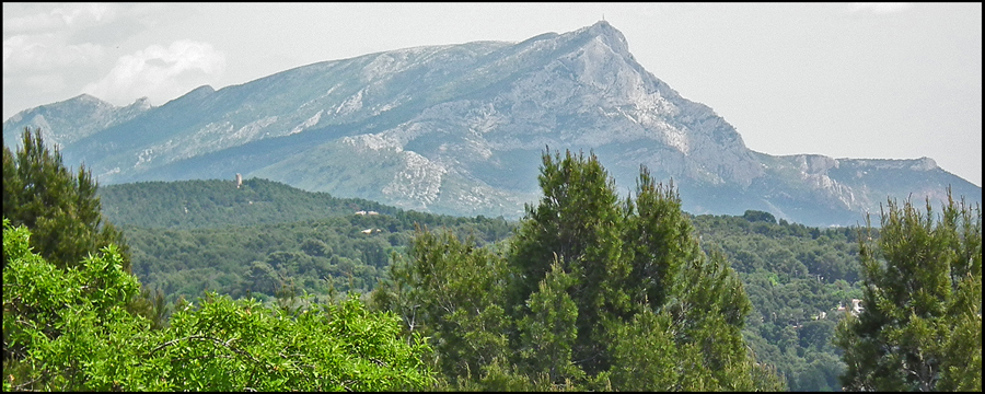
Cézanne’s Montagne St-Victoire

Born in 1839, this extraordinary painter and native of Aix-en-Provence, Paul Cézanne knew and stood shoulder to shoulder with Zola, Pissaro, Guillaumin, Oiler, Monet and Renoir. He studied at the Aix Municipal Drawing School, and in July 1858, failed the baccalaureate. Finally, on 12 November of 1858 he passed and received his certificate with the level assez bien (good enough). From November 1858 to August 1859, he diligently followed the drawing lessons of the municipal school.

Then in 1859, he entered the Aix Law faculty. From November 1859 to August 1860, Cézanne was still in the Municipal Drawing School, dreaming about becoming a painter.

He gave up law studies in 1861 and went to Paris where he found Zola and met Pissaro in the Swiss Academy; discouraged he returned to Aix and started working in his father’s bank while still studying in the Aix Municipal Drawing School.

He failed the Salon in 1864 and in 1865. And so it goes, but he was persistent; in 1882 he was accepted in the Salon for the only time in his career.

Cézanne bought property in 1901 on Chemin des Lauves (renamed Rue Paul Cézanne) that overlooks Aix to the south. During the following year, he had a studio constructed on les Lauves hill from his own plans.

For the next four years, the studio was the creative home of a new art, and Cézanne referred to himself as the “primitive.”On 22 October 1906, Cézanne died of pleurisy contracted while painting.

This atelier, a wood box at the edge of a bluff, has tall windows for the north light. It was from here, for a short time, he created great art. For those with vision and understanding—with perhaps an occasional and modest perception—these thoughts from Cézanne: “When the color is at its best, the shape looks better too. The contrasts and the resemblances in the colors, here is the secret of the drawing and of the shapes.” Not the tools (a spatula) or the techniques and structures taught in the Municipal Drawing School or the standards demanded by the Salon in Paris mattered. It was color, shape and his vision.
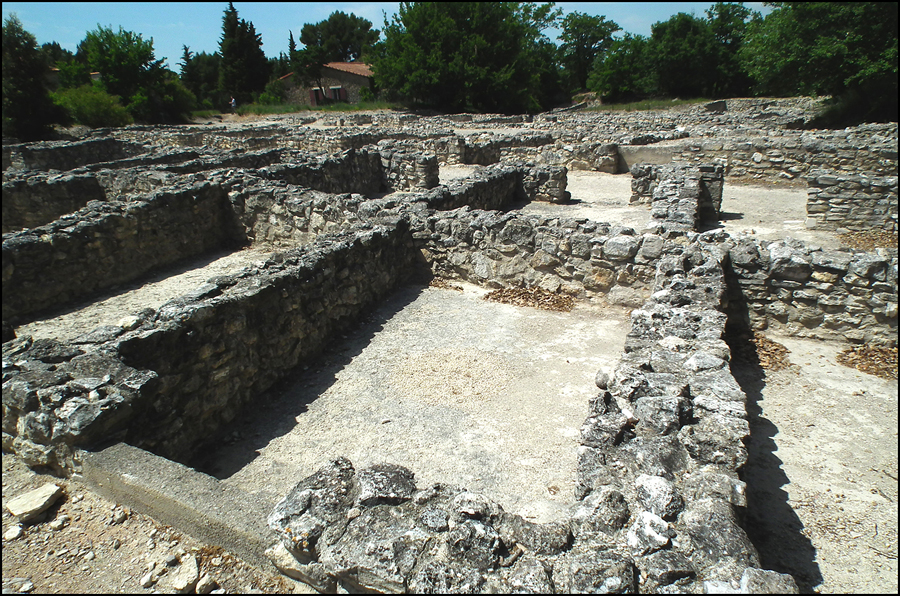
Entremont Oppidum

Entremont Oppidum

The narrative of the Entremont Oppidum stretches back to the early Iron Age, about 500 BCE. At that time, this important archeological site was a Celtic sanctuary. Scholars deduce this by the bas-relief céphaliformes (carvings of heroic-figure skulls, sheaves of wheat and snacks) in lintels. Over a period of 400 years, the populations became an agglomeration with the Ligurians, and were known as Salyens by chroniclers in the Greek outpost of Marseille. The population is estimated at 2,000 to 5,000. These Salyens were both and economic confederation and a military league. The Roman Caius Sextus captured the fortification in 123 BCE and controlled the Plain of Aix and the Arc Valley. Teutomalios, the Salyen emperor, abandoned Entremont with their allies and princes, and Sextus had the city destroyed.

The Oppidum is situated on a plateau overlooking the Arc Valley 200 meters below to the south. The first protective walls on the north were erected in about 175 BCE.

The settlement under investigation covers 3½ hectares, and has three-meter wide, unpaved streets. The interior of the town is arranged in 24-meter by 10½-meter blocks. A typical stone housing unit is 5½ meters by 3¼ meters. In August 2007, investigators had excavated 75 units. Researchers have also unearthed olive oil presses and a storage building capable of holding 3,000 liters.


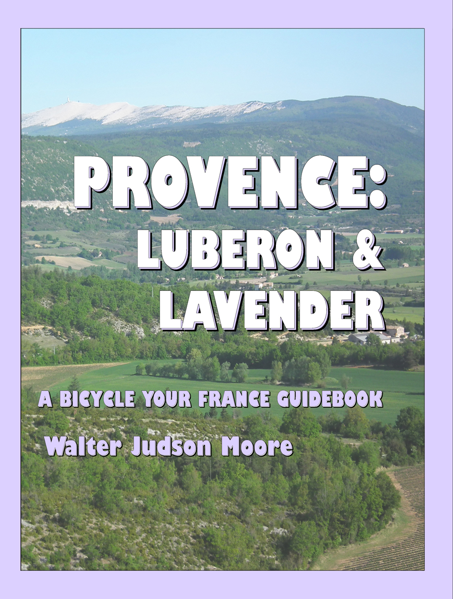
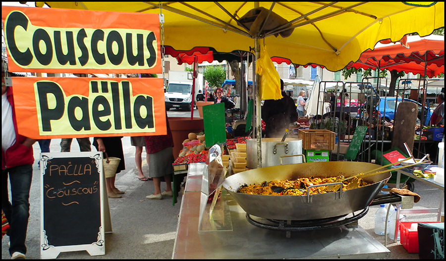
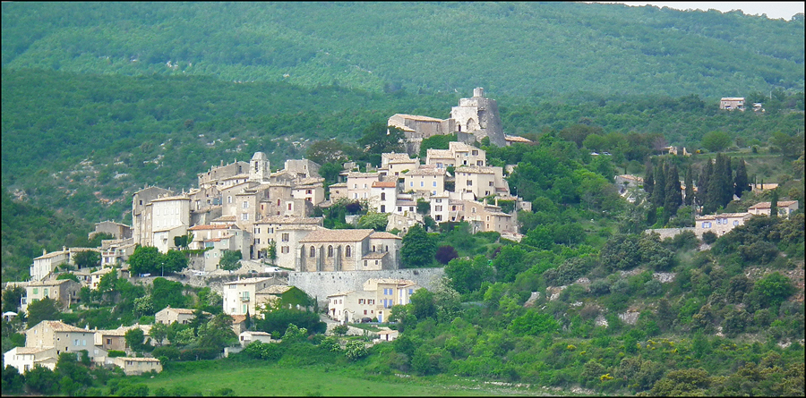
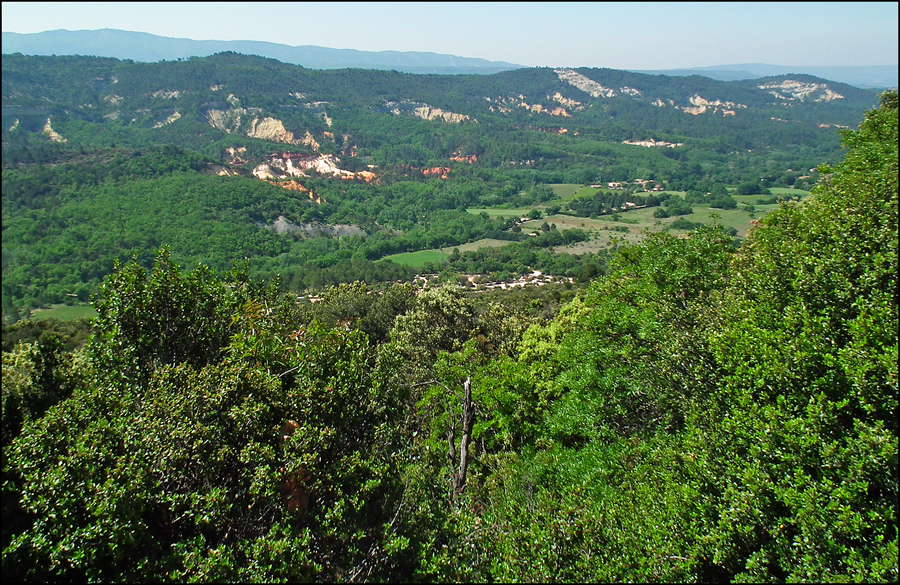
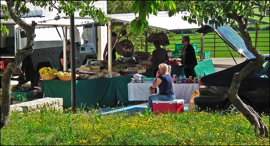
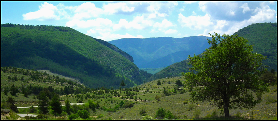
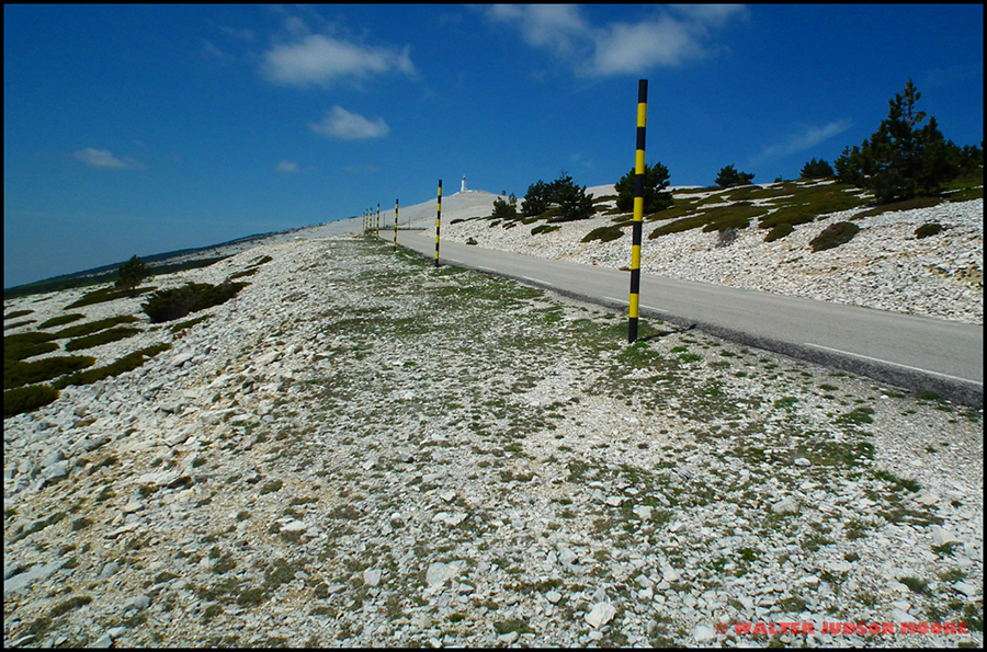
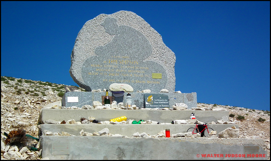
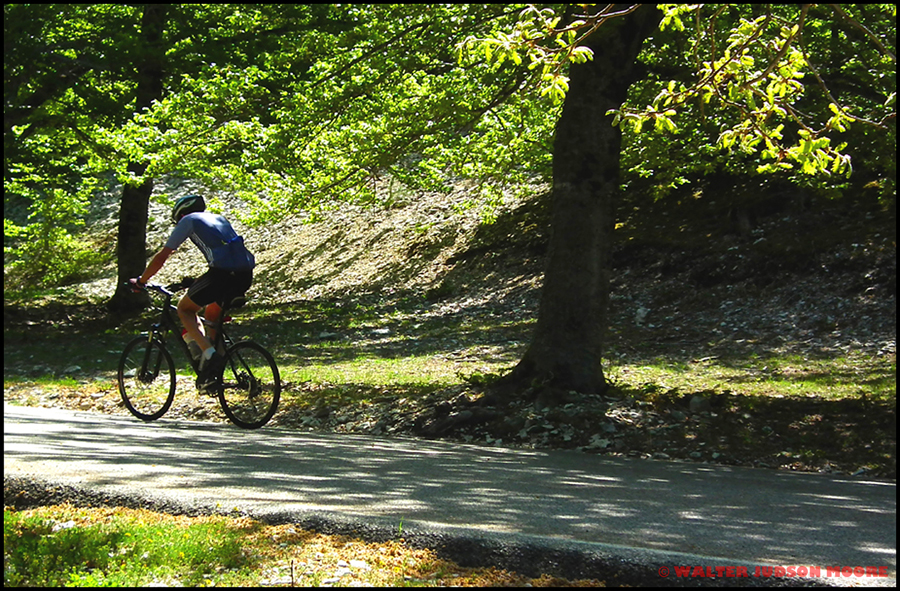
Route map, profile and details of passing interest are in the Aix-en-Provence & Lambesc routeas part of “Provence Luberon & Lavender – a Bicycle Your France guidebook”, May 2011. Dreaming of a cycling vacation/holiday in France? I hope so. Even if you are not planning a trip to France, you may know someone who is, either cycling or motoring. Amazon and iTunes has seven guides of different areas that I crafted.


Provence: Luberon & Lavender: A Bicycle Your France Guidebook – http://www.amazon.com/Provence-Luberon-Lavender-Bicycle-Guidebook/dp/1468096923/

Lot Vineyards to Tarn Gorges front cover

Bonnieux, Apt & Gordes route

Bonnieux for text

Bonnieux

Around this route, you will see a number of medieval hilltop villages including Roussillon, Gordes, Goult, Lacoste and Bonnieux. Approaching Bonnieux from Goult, it reminds one of a birthday cake with layers of red tile roofs circling the old church atop the hill. Follow steps, cobblestone paths and Provençal facades, up past traces of twelfth century ramparts to the heights of the village above the market square at l’Eglise Haute (high church). From there you can view Mont Ventoux north across the Calavon Valley with lavender, vineyards and cherry trees. Close by to the northwest is the village of Lacoste; beyond it are Goult and Gordes. To the south is the Petit Luberon.


Place de la Bouquerie view, Apt for text

Apt

For several centuries, Apt has enjoyed the title of “capitale du fruit confit” (“capital of candied fruit”). Look for Napoleon cherries, apricots, figs, pears bianchetti, clementines and preserved plums plus crystallized exotic fruits such as pineapple from Ivory Coast, oranges from Sicily and citrons from Crete. These fast (not low-cost) calories may be found at several local confectionary shops plus the Saturday and Tuesday morning markets.


Roussillon view

Roussillon

A legend says that Sermonde, wife of the Lord of Roussillon, fell in love with Guilhelm of Cabestang, a young troubadour. The jealous lord killed the lover with a dagger and served the lover’s heart to his wife in the form of a well prepared dish. Sermonde found it delicious, but on learning the truth she threw herself from the cliff. From then on, the color of the cliffs was blood red.

Built on top of the old ochre cliff quarries, the village seems almost illusionary for painters and photographers. The mixtures of oxides allow the ochre a broad range of colors, which can be seen in the landscape, on the front of its houses or trompe l’oeil painting on a portal.

Roussillon needs to be seen to appreciate its uniqueness. Observers note seventeen shades of ochre applied across the houses in the village, derived from the palette of the old ochre quarry nearby. Imagine the reds, yellows, oranges and pinks that merge one into the other as you roam the circling streets. Contrast these colors with the green of the pine trees or the Provençal blue sky against the red cliffs.


Gordes for map

Gordes

This hilltop village is one of the more famous and expensive in Provence. On the approach and after the last steep bend of a road lined with stone walls, Gordes appears. The fortress castle and church dominate the typical houses welded to the rock. Stone alleyways slip between the high houses with many architectural surprises: vaults, antique doors, fountains, views of the valley and the Luberon.

Gordes was built with stone from the rock on which it sits. Because of its geographical location and its history, Romans to the Middle Ages, the Renaissance to the present day, not to mention the marks left by the Inquisition, Gordes has acquired a specific architecture.

The Château du Gordes existed in 1031, but the original was destroyed and then rebuilt in 1525. The austere architecture of the Middle Ages blends with the new lifestyle of the Renaissance. From the Renaissance, note the impressive chimney of the remarkable Salle d’Honneur (Hall of Honor).


Route map, profile and details of passing interest are in the Bonnieux, Apt & Gordes routeas part of “Provence Luberon & Lavender – a Bicycle Your France guidebook”, May 2011. Dreaming of a cycling vacation/holiday in France? I hope so. Even if you are not planning a trip to France, you may know someone who is, either cycling or motoring. Amazon and iTunes has seven guides of different areas that I crafted.


Provence: Luberon & Lavender: A Bicycle Your France Guidebook – http://www.amazon.com/Provence-Luberon-Lavender-Bicycle-Guidebook/dp/1468096923/


Loumarin, Lambesc & Pertuis route

Lourmarin Shops

Lourmarin Shops

Writers, such as Albert Camus (1913 – 1960) and Henri Bosco (1888 – 1976), claim Lourmarin as “the most charming village in Luberon.” The opinion is quite true, but there is a lot more to this village’s history, which seems to incorporate much of Provençal history.

In the ninth century there were two Benedictine monasteries, and in the tenth century, a village is established between them. It belonged to the country of Forcalquier and les Baux family. Sometime prior to the fourteenth century, Lourmarin was transferred to the country of Provence as part of a royal marriage. In 1385 the title, Lord of Lourmarin, appears.

Time goes on, as do the various wars.

Today, you may enjoy eleven restaurants including one of the few outside Paris with two Michelin stars. Also worth exploring is the local wine cooperative.


Pont Suspendu de Mallamart

Pont Suspendu de Mallemort

This is the abandoned suspended bridge across the Durance Rivière looking toward the Chaînes des Côtes.

Many cobbled streets to investigate in Mallemort. North of the eighteenth century St-Michael’s church are the remains of the twelfth century château, formerly one of the Bishop of Marseille’s homes. There is a decent view from the bluffs behind the château of Pont Suspendu de Mallemort. This suspension bridge opened in 1848. It is 300 meters long with a 6-meter wide wooden deck.


Ansouis Ch‰teau

Ansouis Château

The village grew up at the foot of a medieval château, the ancestral home of the family Sabran. In the Middle Ages Ansouis occupied a strategic position controlling the pass between Aptand Aix en Provence. The château overlooks this noted village of small alleys.

The parish of Ansouis appears in the texts in the late eleventh century. The current building cannot be dated exactly, but probably not older than the late thirteenth century, because it is backed inside by the first city wall, which served sealed in archers.


Canal de Marseille

Canal de Marseille

This canal is a major source of drinking water for Marseille. Its length is 80 kilometers along the main channel. A significant achievement in nineteenth century engineering, combining bridges, tunnels, and reservoirs to create a canal over mountainous terrain. Fifteen years under construction, it opened on 8 July 1849. It remained Marseille’s sole water source until 1970, and still provides two-thirds of the city’s drinking water.

The route then clings to the hills, passes over La Roque-d’Anthéron and Charlecal, then turns to the south and enters a long tunnel under the west end of the Chaîne des Côtes.


Route map, profile and details of passing interest are in the Loumarin, Lambesc & Pertuis routeas part of “Provence Luberon & Lavender – a Bicycle Your France guidebook”, May 2011. Dreaming of a cycling vacation/holiday in France? I hope so. Even if you are not planning a trip to France, you may know someone who is, either cycling or motoring. Amazon and iTunes has seven guides of different areas that I crafted.


Provence: Luberon & Lavender: A Bicycle Your France Guidebook – http://www.amazon.com/Provence-Luberon-Lavender-Bicycle-Guidebook/dp/1468096923/


Fontaine-de-Vaucluse & L’Isle-sur-la-Sorgue route

Sorgue Rivire near the source

Sorgue Rivière from the Fontaine-de-Vaucluse

Approaching this natural phenomenon from the village you will finally see a ten meter diameter pit at the foot of a two hundred forty meter high vertical cliff. A river, the Sorgue, flows north from that pit. This is perhaps the largest natural flowing fountain in Europe.

Once the spring rate exceeds 22 cubic meters per second (m3/sec) [not when I was there], water flows over the lip of the pit into the channel. The source of this is rainwater that has seeped into an underground network covering 1,240 square kilometers under Mont Ventoux, Plateau de Vaucluse and Montagne de Lure. On a good day during a wet spring, the flow rate has reached 120m3/sec. The average flow is 630 million cubic meters per year. This volume could fill a supertanker with a two million barrel capacity once every 5½ hours.


L'Isle-sur-la-Sorgue center

L’Isle-sur-la-Sorgue Center

An exceptional village.

The first installations identified in the land ownership registry and maps of Isle sur la Sorgue are those of a channel Arquet now located along the Rue Jean Théophilus. This channel was a natural branch of the Sorgue, which was then converted to install waterwheels—as many as seventeen. The first use of waterwheels was for water-powered feed and grain mills.

The many flocks of sheep in the area led to the development of the wool industry. Wool is not directly fit for use after shearing. The raw wool was placed in tanks filled with water and clay, and then struck by hammers operated by water-power. The Sorgue River, with its clean water and sufficient flow, proved ideal for this production. Also, at St-Nicolas-de-Lagnes, Fuller’s earth clay of unparalleled quality was available. This operation strengthens the wool and scours it.


Moulin St-Pierre

Moulin St-Pierre

The first silk mill in Isle sur la Sorgue was recorded in 1763. It didn’t last long. The town supplied cocoons of silk but the conversion was then reserved by Avignon. Finally in the early nineteenth century, silk production evolved politically (probably the Revolution removed the church from the business) with the creation or conversion of eleven water-powered silk mills.

French army uniforms were red in the late nineteenth century. Red dye comes from a juice extracted from Madder, a plant that grows in Provence. The town’s converted Madder mills grew exponentially and became the capital for production of this dye.

The waterwheels were gradually abandoned in the twentieth century in favor of more efficient electric motors. The technology of the time did not allow these waterwheels to be converted into electricity generators. There were just too many mechanical losses.


Directing Pigeons & Ducks

Directing Pigeons & Ducks

One of my favorites from Provence. Mom was watching closely from just to the left here in L’Isle-sur-la-Sorgue. Also, lots of canals, parks and old waterwheels in the village. A real jewel of France.


Route map, profile and details of passing interest are in the Fontaine-de-Vaucluse & L’Isle-sur-la-Sorgue route as part of “Provence Luberon & Lavender – a Bicycle Your France guidebook”, May 2011. Dreaming of a cycling vacation/holiday in France? I hope so. Even if you are not planning a trip to France, you may know someone who is, either cycling or motoring. Amazon and iTunes has seven guides of different areas that I crafted.


Provence: Luberon & Lavender: A Bicycle Your France Guidebook – http://www.amazon.com/Provence-Luberon-Lavender-Bicycle-Guidebook/dp/1468096923/

Lot Vineyards to Tarn Gorges front cover

Sault & Banon route

Lavender near Banon

Lavender near Banon

Here is a village fastened to the Albion plateau between Montagne de Lure and Mont Ventoux, Banon has kept its historic character and remained natural. Bounded by lavender fields (still green here in the spring), wheat fields and hills, it is faintly aromatic of local aromatic herbs. The village has many bright colors.


Pa‘lla at Banon market

Paëlla at Banon market

This is a fifteenth century fortified medieval site of old streets lined with sixteenth century residences, ancient doorways, sculptured lintels and gateways.

Of course, there is a market every week, and every village market has Paëlla.


Goats near Simiane-la-Rotonde

Goats near Simiane-la-Rotonde

Many of the entities well remembered in Provence always seem to have a historical link that starts “since Roman times.” So it is with Banon à la feuille (leaf), an unpasteurized cheese made mostly from goat’s milk near Banon village. In size, it is circular and approximately 7 centimeters in diameter and 2½ centimeters high. This cheese is pungent, uncooked, unpressed and consists of a fine soft white pâte. The affinage (roughly, refining) period lasts for two weeks, following which it is dipped in eau de vie (brandy) and wrapped in chestnut leaves that have been softened and sterilized by boiling the leaves in a mixture of water and vinegar. Prior to shipping, the leaf-wrapped rounds are tied with raffia. Banon is at its best when made between spring and autumn (this excludes winter, and cycling isn’t good then either).


Simiane-la-Rotonde

Simiane-la-Rotonde

The remains of a twelfth century rotunda is all that may be seen today of the château which once belonged to the noble Simiane-Agoult family. Overlooking the village from the top of its hill, this rotunda is like a large round keep with a large arched ceiling. The rotunda has been recently restored and a traditional music festival is held here every summer.

Simiane-la-Rotonde was a prosperous village in the past, and some grand residences can still be seen today. With the sixteenth century covered market place, stalls and boutiques, it is easy to visualize the lively trading that used to go on of this village.

For many years, Simiane was the regional capital of lavender and today remains an important production center.


Route map, profile and details of passing interest are in the Sault & Banon route as part of “Provence Luberon & Lavender – a Bicycle Your France guidebook”, May 2011. Dreaming of a cycling vacation/holiday in France? I hope so. Even if you are not planning a trip to France, you may know someone who is, either cycling or motoring. Amazon and iTunes has seven guides of different areas that I crafted.

Lot Vineyards to Tarn Gorges front cover

Provence: Luberon & Lavender: A Bicycle Your France Guidebook – http://www.amazon.com/Provence-Luberon-Lavender-Bicycle-Guidebook/dp/1468096923/


Sault & Saturnin-lès-Apt route

St-Saturnin-lŽs-Apt heights

St-Saturnin-lès-Apt

With a southern exposure, good water from the hills to the north and decent soil, the village has a privileged agricultural location. Cherries, vineyards, olives, truffles, and lavender flourish.

The dominant view east and west along the valley from the rocky spur 130 meters above the valley explains the remains of a tenth century stronghold. Today there are only the ruins of the ramparts near the chapel and the restored twelfth century fortress.

Along the village lanes are old houses—including a Knight Templar’s house of the thirteenth century—balconies, fountains, laundries and decorated doors.

This year-round village has a grocery, bakeries, a butcher, a real estate agency, restaurants, hotel, bed and breakfast and gîtes.

Ocres de Rustrel

Ocres de Rustrel

As this route descends on D30 five kilometers from Rustrel, the Calavon Valley comes into view with orange outcroppings. This is the Ocres de Rustrel, an enclave in a land devoted to the cultivation of the vine. This curiosity of nature is not a southern Utah national park in the United States (too much green), but a valuable deposit of ocher.  Nevertheless, it is a landscape prompting memories of the Far West with hues ranging from ivory to brick red.

A costly accumulation of ocher sediments with 25 colors in the area. Until its peak in 1929, the industry produced 40,000 tons of ocher pigment. The last ocrier (a factory that processes the ocher sands into pigment) in Rustrel ceased operations in 1992. Environmental concerns with the fine residual sand clogging rivers from the ocriers along with new chemical dyes have sounded the death knell for commercial exploitation of ocher turning Provençal Colorado into a place for walking.

There are four foot trails allowing access. The shortest, at a bit over a kilometer with steep climbs to the fairy chimneys—columns topped by picturesque pointed hats scuffed by the picks of former harvesters. The earth offers a kaleidoscope of colors, merging agreeably with the thick green forest, blue sky and white fluffy clouds.

Sunday MarchŽ in St-Christol

Sunday Marché in St-Christol

North of the Grand Luberon, this village is surrounded by splendid scenery. St Christol is a hub of caving; enthusiasts will enjoy the numerous potholes on the Plateau d’Albion.

Around St-Christol there are lavender fields stretching out of sight, alternating with wheat fields; these landscapes are almost clichés of Haute Provence.

In the village there is a Romanesque church founded in 1119 by the Benedictines of St-Andre de Villeneuve les Avignon. Its decor may surprise you; it is a remarkable plant and animal bestiary with snakes, lions and other beasts decorating the columns and somewhat mystical.


Sault Valley southwest of Sault

Sault Valley southwest of Sault

In the seventh century Saracens occupied many large and formerly Roman communities in the Sault Valley. In early autumn 859, driven by the Normans who occupied the valley of the Rhone, Provence and the Lower Durance, Charles I, King of Provence and great grand-son of Charlemagne, took refuge in Sault.

Sault sovereignty went to Isnard in 1204. Then Francis of Agoult held the Barony of Sault. A letter from 1561, gave all fiefs to Lord Agoult. The widow of Francis of Agoult died in 1613, and Sault was run by the Créquy-Lesdiguieres family and then passed to the Duc de Villeroy in 1703.

On 25 June 1793, the Convention of the First Republic created the Vaucluse Department, consisting of Avignon, the Comtat Vaucluse, the Principality of Orange, and Apt. On 28 April 1794, Louis Gabriel de Neufville de Villeroy, the last Earl of Sault, was sentenced to death by the Revolutionary Tribunal of Paris. The execution took place the same day.

During World War II, reviving an old tradition, Sault served as a refuge for many patriots and became the center of the resistance group known as “Maquis Ventoux.” Two leaders, Colonel Philippe Beyne and Max Fischer, aka Anatole, served with distinction.

In August 1944, during a battle between the Resistance and the French Forces of the Interior in the German army, Sault suffered. As a result it was awarded the Croix de Guerre with Etoile (star) de Vermeil.


Route map, profile and details of passing interest are in the Sault& Saturnin-lès-Apt route as part of “Provence Luberon & Lavender – a Bicycle Your France guidebook”, May 2011. Even if you are not planning a trip to France, you may know someone who is, either cycling or motoring. Amazon and iTunes has seven guides of different areas that I crafted.

Lot Vineyards to Tarn Gorges front cover

Sault, Séderon & Montbrun-les-Bains route

le Menon Valley

le Menon Valley: Hannibal’s Route(?)

Hannibal crossed the Pyrenees and then what is now France, to the lower Rhône valley in August 218 BCE.

He and his army of 50,000 infantry, 9,000 cavalry and 37 elephants, were on their way east to the Po Valley to confront the Romans in the Second Punic War.

The army moved up the west bank of the Rhône Rivière to north of Avignon. They took three days to cross the river southwest of Orange. From that point, there are two most probable routes; north and south, both using Mont Ventoux as a landmark. The southern route is up l’Ouvèze Rivière and le Charuis Rivière past Mévouillon and Villefranche-le-Château.

Ch‰teau du Montbrun-les-Bains tower

Château du Montbrun-les-Bains Tower

Charles Dupuy-Montbrun (1530-1575), who like many lords of the time embraced Calvinism with zeal and fanaticism of a new convert. So starts one of the Wars of Religion.

When he was in his early twenties he fought in Flanders in the wars of Henry II. Wounded in the face during a fight, he is dubbed Charles le Balafré (Scarface). He returned to Montbrun and learns that one of his sisters, Jeanne Du Puy, traveled to Geneva to join the Reformation. Enraged, he went to Geneva with the intention of bringing his Catholic faith back to her or to kill her. But his sister talked him into listening. Charles was impressed by the sermons of Theodore Beza, a noted follower of John Calvin.

Returning to Montbrun, Charles was more Huguenot than Calvin himself. He quickly abolishes the Catholic worship in Montbrun and changes the church into a Protestant church. He installed a Protestant pastor and forces his vassals to convert. But he was more hooked on feudal independence than religious strife. Charles fortifies his castle, arms his peasants and uses foreign soldiers to set up a state of open rebellion.

Another part of the Hundred Years War.

la Nesque Valley

la Nesque Valley from Aurel

Many caves are located near the town where archaeologists have found stone tools indicating that the area had been occupied in Neolithic times.

During the Wars of Religion, Ménerbes Catholic League troops seized Aurel in 1576, as the residents were too favorable to Protestants and the reformers of Geneva. René de La Tour du Pin-Gouvernet, a Protestant captain, returned in 1591 and bombarded the place to capitulation.

In 1630 and 1631, the plague decimated the village despite a protection line established around the village.

The first genuine Mont Ventoux hiker was the Abbe Jean-Antoine Constantin, Aurel’s parish priest. From 1783 to 1788, often accompanied by the Marquise de Montbrun, he made several expeditions to the summit of Ventoux.

Toulourenc Gorge

Toulourenc Gorge

I do like Gorges, but the significant landmark of Provence is Mont Ventoux, which is north and slightly west of Sault.

Route map, profile and details of passing interest are in the Sault, Séderon & Montbrun-les-Bains route as part of “Provence Luberon & Lavender – a Bicycle Your France guidebook”, May 2011. Even if you are not planning a trip to France, you may know someone who is, either cycling or motoring. Amazon and iTunes has seven guides of different areas that I crafted.

http://www.amazon.com/Provence-Luberon-Lavender-Bicycle-Guidebook/dp/1468096923/

Mont Ventoux Route

Mont Ventoux Observatory

Mont Ventoux Observatory and Final Kilometers to the Summit

Hurbert turned me around. “It’s REALLY, REALLY Hard.” And 10 days later I was on the Géant de Provence. He was very correct.

This is the last Alpine mountain ridge before the Rhône plain and can be seen almost from everywhere in Provence. The name Mont Ventoux means windy mountain, and cyclists know why.

The climb starts in earnest after the bend left at St Estève There is not any rest until you reach the Chalet Reynard. In the forest between St-Estève and Chalet Reynard the ascents rarely are less than 8% and there are long grades of 10%. After Chalet, the ascent is only 7%, for a while, and then ramps back up to over 10%. A fortunate few may not experience the infamous wind that tries to blow you out of your saddle. Try to enjoy the view over Provence to your left while going up the mountain over a lunar—lunatic?—landscape. Finally, take the last hairpin to the right at over 10% and you’re there. Congratulations. Buy an overpriced cycling shirt.

Simpson Memorial

Simpson Memorial

Ventoux gained worldwide notoriety when it claimed the life of the great English cyclist Tom Simpson, who died here on 13 July 1967 from a combination of chemicals he was reported to have ingested—amphetamines and alcohol— plus heat exhaustion. He was wildly weaving over the road before falling down. Delirious, he asked spectators to “put me back on my bike!” He rode to within a half mile of the summit before collapsing dead, still clipped into his pedals (I am now learning that there is a lot more to this story). In 1970 Belgian professional Eddy Merckx rode to near collapse while winning the stage. He received oxygen, recovered, and won the Tour de France.

Mont Ventoux

Mont Ventoux

Nineteen hundred meters up there, is completely different from 1,900 meters any place else. There is oxygen but no vegetation or life, just rocks. To quote Lance Armstrong “It’s more like the moon than a mountain.”

“Physically, the Ventoux is dreadful. Bald, it’s the spirit of Dry: Its climate (it is much more an essence of climate than a geographic place) makes it a damned terrain, a testing place for heroes, something like a higher hell. [It] is a god of Evil, to which sacrifices must be made. It never forgives weakness and extracts an unfair tribute of suffering.” Roland Barthes, French philosopher and bicycle racing fan.

Up there the Mistral wind blows an average of 240 days per year. The top recorded speed is 313 kilometers per hour (197 mph) on 20 March 1967 (almost no wind the day I climbed the giant).

Climbing Mont Ventoux

Climbing Mont Ventoux

The cycling directions for this route are simple. Ride east out of Bédoin on D974 to Malaucène. From there, bicycle south and east back to Bédoin.

Climbing is another story. There is one climb, it starts in Bédoin and is rated Haute Category (above the rating system) by the organizers of the Tour de France. This Giant of Provence gains 1,620 meters in 22 kilometers with 5% to 11% ascents. This is far and away the most popular cycling mountain in the south of France.

Route map, profile and details of passing interest are in the Mont Ventoux route as part of “Provence Luberon & Lavender – a Bicycle Your France guidebook”, May 2011. Even if you are not planning a trip to France, you may know someone who is, either cycling or motoring. Amazon and iTunes has seven guides of different areas that I crafted.

http://www.amazon.com/Provence-Luberon-Lavender-Bicycle-Guidebook/dp/1468096923/